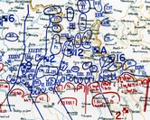
WWII Maps
These DVDs contain color scans of German operational maps captured by the US Army during World War II. All images are JPEG files.
These DVDs contain color scans of German operational maps captured by the US Army during World War II. All images are JPEG files.
Various French Fortification and Troop Disposition Maps 1940
61 French maps and overlays (various scales, mostly 1:500,000 and 1:200,000) captured by the German Army after the France. Collection includes two maps of French defenses in the Thionville and Uckange areas; nine maps of French defenses along the Rhine River; seven maps of French unit dispositions north of Thionville on 11, 12, 13, 14, 15, 16 May 40; five maps of French unit dispositions in the Crunes-Aumetz area; two maps of defenses and troop dispositions in the Maubeuge area; map of the IX Armee in the Mezieres area on 5 May 1940; one map of troop dispositions in the Sarre region; twelve Italian maps of Italian of French troop dispositions along the Franco-Italian border, May-Aug 1939. Maps were scanned in color at 1,200 dpi. $15
German Military Situation Maps: North Africa 1941-42
86 maps from the Operations Staff of the German Armed Forces High Command (Oberkommando der Wehrmacht, OKW) that detail the disposition and movements of German forces in Libya, Egypt, and Tunisia from Dec 41 to Dec 42. Maps in the series have varying scales from 1:200,000 to 1:1,000,000 and cover the following dates: 29 Dec 41; 8, 9, 12, 25, 26, 30 Jan 42; 2, 3, 7, 8, 11, 19, 28 Feb 42; 6, 19, 31 Mar 42; 2, 9, 18, 30 Apr 42; 20, 27, 29, 30 May 42; 3, 6, 11-18, 20, 22, 24, 26, 28, 29, 30 Jun 42; 5, 15, 19, 22, Jul 42: 18, 19, 25 Aug 42; 1 Sep 42; 17-20, 22, 23, 25-30 Nov 42; 1-3, 5, 7, 9, 11, 15-19, 21, 23-26, 28, 30 Dec 42. Maps were scanned in color at 1,200 dpi. $20
German Military Situation Maps: Italy Nov 43 - Mar 44
40 maps from the Operations Staff of the German Armed Forces High Command (Oberkommando der Wehrmacht, OKW) that detail the disposition and movements of German forces in Italy from 20 Nov 43 to 22 Mar 44. Most of maps also include an Allied order of battle and unit locations. Maps in the series vary in scale from 1:200,000 to 1:1,000,000 and cover the following dates: 20, 23, 27 Nov 43, 3, 5, 8, 13, 16, 20, 22, 23 Dec 43; 4, 7, 8, 10, 15, 17, 24, 27, 29 Jan 44; 1, 4, 9, 11, 21, 24 Feb 44; 1, 2, 4, 5, 7, 9, 12, 13, 15, 18. 21, 22 Mar 44, plus a map of the German counterattack plan against the Anzio bridgehead. Maps were scanned in color at 800 dpi. $15
Various German Atlantic Wall Fortification & Situation Maps 1942 & 44
12 maps of Atlantic Wall fortifications: three undated 1:200,000 maps of corps and division sectors along the Franco-Spanish border and southern coast of France from Spain to the Toulon area, incuding division, army, marine coastal artillery positions; four Lage West 1:25:000 situation maps of Festung Brest dated 28, 29, & 30 Jun 44; one undated 1:80,000 map of coastal artillery sector Cherbourg and the Cotentin Peninsula; four 100,000 maps titled “OB West OBKDO.H.GR.D. Ausbaustand der Kustenverteidigung,” dated 1 May 42, 1 Aug 42, & 18 Nov 42, that show in graphic form the percentage of planned, under construction, and completed Atlantic Wall fortifications in France. The maps were scanned in color at 800 dpi. $12
Note: Operations and intelligence maps can be also found in the WWII German Records Section of this catalog, including these three items which have many operational maps:
- T-78 Roll 136: OKH East & West Front Maps 1944-45
- T-78 Roll 672: OKH Eastern Front Maps & Combat Reports 1941-44
- T-311 Roll 136: Army Group North Map Atlases of Operations, Russia 1941-43